
A Foundational Reading In The Political And Historical Geography Of Sudan
Some Publications Stand Out As Indispensable Beacons For Understanding The Nature Of Homelands And Their Formation. Among These Immortal Works Emerges The Book “The Republic Of The Sudan. A Regional Geography.” (K. M. Barbour) As A Deep Scientific And Analytical Document That Dissects The Sudanese Body With Great Brilliance. This Masterpiece, Penned By The Researcher K. M. Barbour, Is Not Merely A Narrative Book, But Rather A Serious And Strenuous Attempt To Gather And Coordinate The Essence Of Thoughts And Results Of Many Scientists And Researchers Who Dedicated Their Efforts To Studying Sudan During The First Half Of The Twentieth Century. The Book Aims To Shed Light On Vital Topics Such As The Geographical Distribution Of Human Settlements, The Vast Regional Disparities In The Fields Of Agriculture And Animal Husbandry, As Well As Tracking The Path Of The Gradual Spread Of The Modern Cash Economy Across All Parts Of Sudan. The Author Did Not Merely Rely On Written Sources, But Enriched His Work With His Direct Personal Observations And Intensive Field Inquiries, Attempting To Cover As Much As Possible Of This Vast Country.
The Book Begins Its Journey By Framing The Political Situation Of The Republic Of Sudan, Starting Its Discussion With A Defining Moment In The Country’s History; Namely, The First Of January 1956, Which Is The Day Sudan Was Declared As A Fully Sovereign Independent State Under The Name “The Republic Of Sudan”. At That Historic Moment, Sudan Sat On The Throne Of The African Continent As The Largest Politically Independent State, Where Its Geographical Area Reached Approximately Two And A Half Million Square Kilometers. From A Purely Geographical Perspective, The Author Explains That This State Is Merely A Part Of A Great African Belt Stretching Across The Continent On Almost The Same Latitude, Starting From The Ethiopian Highlands In The East To The Coasts Of The Atlantic Ocean Which Are About Six Thousand Kilometers Away In The West. And This Broader Belt, As Is The Case With The State Itself, Bears The Name “Sudan”, Which Is An Abbreviation And Arabization Of The Ancient Arabic Term “Bilad As-Sudan” (Land Of The Blacks), Which Historically Refers To The Lands Where Arabs Met With Negroid Peoples During Their Penetration Into The Depths Of The African Continent.
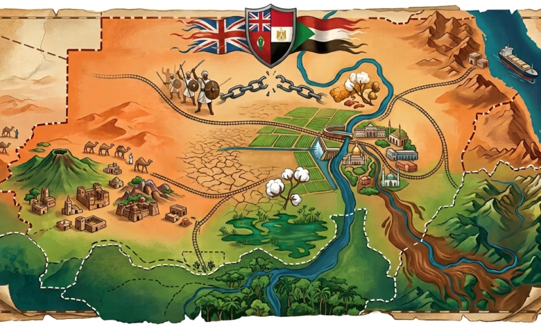
One Of The Most Complex Periods In The Modern History Of Sudan, To Which The Book Dedicates Ample Analytical Space, Is The Era Extending From 1898 To 1955, During Which The Country Was Known As “Anglo-Egyptian Sudan”, And Was Subject To A Unique System Of Governance Officially Described As A “Condominium”. Under This System, The Supreme Authority And The Final Word Were In The Hands Of A Single Person Holding The Title Of “Governor-General”, Who Was Theoretically Responsible Before Both The Egyptian And British Governments For The Good Administration Of The Country. However, Practically And On The Ground, The Book Asserts That The Position Of Governor-General Was Always Distinctly British, And That The Actual Reins Of Power Were Concentrated Almost Entirely In British Hands, Although The Nominal Association With Egypt Had A Noticeable Impact On Modifying And Restricting The British Freedom Of Action In Several Aspects. This Exceptional Situation Distinguished Sudan From Other British Colonies In Africa, And Had A Profound Impact On Settling Fateful Issues Such As Border Demarcation, Determining The Nationality Of Sudanese People, Consular Representation, Immigration And Customs Regulations Between Egypt And Sudan, The Distribution Of Nile Waters, Leading Up To The Development Of Political Institutions As The Sudanese Approached Achieving The Right To Self-Government And Independence.
The Book Delves With Us Into The Roots Of This Dual Intervention, Explaining That Modern Egyptian Interest In Sudan Actually Began In 1821, When Muhammad Ali Pasha, Who Had Recently Tightened His Grip On Egypt, Decided To Send Military Forces Led By His Son Ismail To Invade Sudan. Muhammad Ali’s Primary Motive Was To Build A Vast Empire In Pursuit Of The Revenues And Resources That Could Be Reaped From It, Whether That Was Represented In Pure Gold Or In Fetching Slaves To Support His Growing Armies. This Campaign Resulted In The Establishment Of A Central Administration That Took Khartoum As Its Capital, Along With Deploying Military Garrisons In Strategic Areas Such As Kassala, Al-Qadarif, And Suakin In The East, El-Obeid And Then El-Fasher In The West, And Fashoda And Gondokoro In The Deep South. This Administration, Popularly Known As “Al-Turkiya”, Succeeded In Introducing Some Aspects Of Modernization Such As The Nile Steamboat Service, Starting To Extend A Railway Line Southward From Wadi Halfa, Establishing A Telegraph Network Connecting Cairo And Khartoum, As Well As Launching Some Minor Agricultural Projects In The Eastern Deltas.
However, As The Book Recounts, The Lack Of Effective Control From Cairo, And The Low Competence Of Many Egyptian Officials At That Time, Led To The Spread Of Serious Abuses In The Administration. Tax Collection Operations Were Characterized By Extreme Cruelty, And Worse Still, Even After The Khedive Of Egypt Announced The Abolition Of Slavery In 1857, Many Officials Continued To Turn A Blind Eye To The Slave Trade That Targeted Negroid Tribes In The South, And Sometimes Even Participated In It. These Practices Sowed The Seeds Of Deep Hatred; The Southern Tribes Began To View Egyptians And Slave Traders From Northern Sudan With Intense Hostility, While In The West, Powerful Arab Tribes Began To Despise And Loathe The “Turks”—Which Is The Title They Bestowed Upon All Foreigners Indiscriminately Since Egypt Was Still Nominally A Part Of The Ottoman Empire.
This Accumulated Tension Eventually Exploded, Reaching Its Climax In 1881 Through A Massive Revolution Led By Muhammad Ahmad, A Pious Man From The Dongola Region, Who Declared Himself The “Expected Mahdi”, Claiming That He Was Commissioned By God To Establish A State Of Truth And Justice On Earth. This Historically Coincides With The Increasing British Influence In Egypt, Yet Gladstone’s British Government Was Not Willing At That Time To Extend Its Influence Southward Across The Nile. When The British Realized The Egyptians’ Inability To Quell The Revolution, They Refused Direct Military Intervention And Contented Themselves With Sending General Gordon To Khartoum With A Specific Mission To Evacuate The Egyptian Garrisons. But The Winds Blew Counter To What The Ships Desired, As The Necessary Forces For An Organized Evacuation Were Not Available, And Soon Khartoum Was Besieged And Fell In January 1885, Where Gordon Was Killed, And The Entire Lands Of Sudan—Except For Wadi Halfa And Suakin—Fell Into The Hands Of The Mahdist Revolutionaries.
Thus, The Book Highlights A Strange Historical Paradox; While The Powers Of Europe Were Gathering At The Berlin Conference In 1885 To Divide The African Continent And Distribute Spheres Of Influence, Sudan Was Witnessing The Birth Of The First Independent National Sudanese Government. After The Death Of The Mahdi, He Was Succeeded By The Khalifa Abdallahi Al-Ta’aishi Who Tightened His Grip On The Country And Established A Regime Based On A Strict Religious Vision, Rejecting Any Cultural Contact With The Outside World, And Launching Unsuccessful Military Attacks Against Egypt And Ethiopia. According To The Mahdist Doctrine At That Time, The Necessity Of Pilgrimage To Mecca Was Abolished, Considering That Visiting Omdurman And The Mahdi’s Tomb Was Sufficient For Believers.
It Was Not Expected That The European Colonial Powers Would Respect The Independence Of Sudan For A Long Time, And In 1894 The French Reached The Bahr El Ghazal Region From The West, While The Belgians Crossed The Water Divide Between The Nile And The Congo. Concurrently With The Italians’ Efforts To Expand Their Influence In Eritrea, Britain Decided That The Time Had Come To Stop These Incursions And Secure The Southern Borders Of Egypt, Especially To Ensure The Continuous Flow Of The Nile Waters That Fed British Agricultural Projects In Egypt. The Campaign To Recover Sudan Was Launched Under The Leadership Of Sir Herbert Kitchener, Using Joint British And Egyptian Forces, In An Organized And Deliberate Advance Interspersed With Building A Railway Line Across The Desert From Wadi Halfa To Abu Hamad. By The Second Of September 1898, Matters Were Settled At The Battle Of Karari (Or The Battle Of Omdurman), Bringing An End To The Era Of The Mahdist State.
The Author Then Moves Us To Explore The Complexities Of The Geographical Borders Of Sudan Which Were Drawn By That Colonial Era. The Book Explains That Sudan Is Not Merely A Random Carving Out Of Desert Lands And Savannas, But Possesses A Stunning Hydrological Unity Being That It Includes A Large And Pivotal Part Of The Nile Basin. However, The Political Borders Drawn For The State Are Characterized By Extreme Diversity; Some Were Surveyed And Precisely Defined, While Others Pass Through Unsurveyed Or Uninhabited Areas, And Still Others Bisect The Lands Of Entire Tribes. Among The Most Prominent Disputes Addressed By The Book Is The Border Dispute With Egypt, Which Centers Around Whether The Border Should Strictly Follow The 22nd Parallel North As Stipulated In The 1899 Agreement, Or Follow The Actual Administrative Borders That Annexed Some Lands To Suit Tribal Distribution, Such As Annexing The Lands Of The Ababda Tribe To Egypt And The Lands Of The Bishariyyin Tribe (Of The Beja) To Sudan.
As For The South, The Book Reveals The Absence Of Any Clear Natural Lines For The Borders With Kenya, Uganda, And The Belgian Congo. On The Western Side Of The Nile, It Was Arbitrarily Agreed That The Border Would Follow The Water Divide Between The Nile And Congo Systems, Which Led To An Almost Complete Division Of The Settled Tribes There, Most Notably The Zande Tribe Which Was Demographically Torn Apart To Leave Hundreds Of Thousands Of Its Members Distributed Among Sudan, The Belgian Congo, And French Equatorial Africa. This Haphazard Division, Which May Have Reduced Tribal Clashes In The Past, Poses Tremendous Challenges Today For Integrating These Populations Into The National Fabric Of The Modern States To Which They Belong.
The Genius Of The Place; A Reading In The Geomorphology And Climate Of Sudan
We Move From The Complex Political Entanglements And The Borders Drawn By Man With His Blood And Greed, To Another Painting That Is Firmer And More Profoundly Impactful; It Is The Painting Carved By The Mighty Forces Of Nature Over Millions Of Years. The Author Plunges Us In This Stage Of His Cognitive Journey Into The Material And Physical Composition Of The Sudanese Body, To Decipher For Us The Mysteries Of The Topography, Climate, And Water Networks That, Together, Formed The Spatial Stage Upon Which Successive Civilizations And Cultures Interacted. The Transition From Political Geography To Physical Geography In This Massive Tome Is Not Merely A Typical Academic Progression, But Rather A Philosophical Attempt To Understand How Nature Dictates Its Harsh Conditions Upon Its Inhabitants, And How Topography And Climate Forge The Identity Of The Nation And Its Ways Of Living.
Barbour Opens This Section With A Precise Dissection Of The Vast Geomorphological And Topographical Structure Of Sudan, Noting That The Dominant Feature Of This Enormous Geographical Expanse Is The Extended Flatness. Sudan In Its Entirety Is Essentially A Massive And Wide Basin, Characterized By Its Flat Plains That Stretch For Hundreds Of Kilometers Without Having Their Monotony Broken Except By Some Scattered Mountainous Formations That Emerge Like Isolated Islands In An Ocean Of Land. The Book Pauses At Length Before The Central Clay Plain, A Unique Geographical Phenomenon That Constitutes Sudan’s Beating Heart And Its Strategic Agricultural Reservoir. This Deep Heavy Clay Soil, Which Cracks In Dry Seasons And Turns Into Sticky Swamps In Rainy Seasons, Imposed A Special Rhythm On The Movement Of Herders And Farming Methods. In Contrast To This Flatness, The Red Sea Hills Range Emerges In The East As A Solid Rocky Barrier Separating The Nile Valley From The Coast, While In The Far West, The Majestic Jebel Marra Rises With Its Extinct Volcanic Peaks And Cavities That Embrace Small Lakes And Support A Mild Local Climate Contrasting Sharply With The Surrounding Aridity. And In The Heart Of The Central Plains, The Nuba Mountains Rise With Their Granitic Rocky Formations To Provide Historic Safe Havens For Human Groups That Took Shelter In Them From The Invasions Of The Exposed Plains.
And No Geographical Study Dealing With Sudan Can Ignore The Vital Artery That Connects The Joints Of This Vast Country; Namely, The Nile River System. Barbour Dedicates Highly Rich Chapters To Analyzing The Complex Hydrological Network That Penetrates The Sudanese Lands From South To North. In A Sober Scientific Style, The Author Describes The Slow And Meandering Journey Of The White Nile, Coming From The Equatorial Lakes, And How This River Faces Its Harshest Test When It Enters The Vast “Sudd” Swamp Region In The South Of The Country. There, Enormous Quantities Of The River’s Sweet Water Dissipate Through Evaporation And Transpiration Amidst The Dense Papyrus Forests, Only For The River To Emerge From This Watery Maze Emaciated But Continuing Its Patient Flow Towards The North. In A Stunning Dramatic Contrast, The Book Depicts The Rush Of The Roaring Blue Nile From The Highlands Of Ethiopia, Carrying With It Not Only Massive Amounts Of Water During Flood Seasons, But Also The Rich Silt That Rejuvenates The Soil And Grants It Fertility. At The Confluence Point Of These Two Great Rivers In Khartoum, A Geographical And Historical Painting Is Formed That Summarizes The Story Of Life In Sudan, Before They Are Joined By The Seasonal Atbara River, For The Unified Nile To Complete Its Long Journey Confronting The Barren Desert Sands Until It Reaches Its Mouth.
And With Tracing The River Courses, The Book Weaves The Threads Of The Organic Relationship Between Topography And Climate. Barbour Sees That Climate Is The Hidden Maestro That Directs The Rhythm Of Environmental And Human Life In Sudan. The Country Spans Sharply Contrasting Climatic Zones, Governed By The Movement Of The Intertropical Convergence Zone (ITCZ) Which Oscillates North And South With The Seasons Of The Year. The Analysis Explains How The Climate Grades Sharply And Dramatically From The Extreme North, Where The Sahara Desert Imposes Its Absolute Dominance With A Severely Arid Climate And An Almost Complete Absence Of Rain, Down Towards The Center Where The Semi-Arid Savanna Belt Begins, Reaching The Extreme South Which Enjoys Heavy And Prolonged Rains And A Humid Tropical Climate. This Decisive Rainfall Gradient Is Not Just Climatic Statistics, But Represents Dividing Lines That Pinpoint Exactly Where Cash Crops Can Be Grown, Where Tribes Are Forced To Continuously Migrate In Search Of Pasture, And Where Agricultural Communities Settle Around Permanent Water Sources. The Fluctuation Of These Rains From Year To Year, As The Book Cautiously Documents, Represents The Greatest Existential Challenge That Formed The Mentality Of The Sudanese Person And Made Him Constantly Prepared For The Surprises Of Nature.
And As A Reflection Of These Climatic Variations, The Author Dedicates Ample Analytical Space To The Vegetation Cover Map Which Appears Like A Mirror Reflecting The Amounts Of Rainfall And Its Temporal And Geographical Distribution. The Environmental Scene In The Arid North Begins With Barren Sandy And Rocky Deserts That Grow Nothing But A Few Scattered Thorny Shrubs That Resist Drought Fiercely And Stubbornly. As We Move Further South, The Vegetation Cover Gradually Thickens For Us To Enter The Poor Savanna Belt, Then The Zones Of Tall Grasses And Acacia Forests (Such As Talh And Hashab) Which Constitute The Most Important Forest Wealth For Sudan And The Source Of Gum Arabic For Which It Is Globally Renowned. In The Extreme Southern And Southwestern Fringes, Where Humidity And Rainfall Rates Rise, Nature Transforms Into A Dense Canvas Of Tropical Rainforests And Gallery Forests Stretching Along The Banks Of Permanent And Seasonal Rivers, Creating An Ecosystem Completely Different From The Northern Desert Environment. This Tremendous Biological Diversity Meticulously Observed By Barbour Forms The Solid Foundation For Understanding The Economic And Human Diversity That Will Pave The Way For Us In Our Upcoming Reading To Explore Human Geography, Population Distribution, And Land Use Patterns In This Sprawling Country.
The Theater Of Man; A Reading In Human Geography And The Demographic Mosaic Of Sudan
The Geographer Scientist K. M. Barbour Turns With Us In His Reference Book “The Republic Of The Sudan: A Regional Geography” Towards Studying The Most Important And Most Complex Component In This Equation; Namely, Man. The Harsh And Contrasting Natural Theater Formed By Geography Was Never An Empty Theater, But Was Since The Dawn Of History A Melting Pot In Which Human Migrations And Multiple Cultures Melted And Interacted. In This Section Of The Book, Barbour Highlights How Geography Did Not Only Determine Where The Sudanese Live, But Also How They Live, And What Social And Economic Structures They Invented To Tame This Vast Environment And Survive Under Its Wing.
The Writer Begins With The Stunning Ethnic And Cultural Mosaic Of Sudan, Asserting That This Country Represents A Microcosm Of The Entire African Continent, Where The Blood And Cultures Of The Arab Islamic World Converge With The Roots Of Negroid Africa. Barbour Reviews The Ethnographic Map, Starting With The Arab And Arabized Tribes That Historically Dominated The Central And Northern Plains, Carrying With Them Their Language, Religion, And Lifestyles Based On Herding, Trade, And Riverine Agriculture. On The Other Hand, He Sheds Light On The Indigenous Non-Arab Groups That Retained Their Unique Characteristics Thanks To Geographical Barriers; In The East, We Find The Beja Tribes Who Took Refuge In The Harsh Red Sea Mountain Range And Preserved Their Languages And Ancient Pastoral Heritage For Thousands Of Years. In The West, The Fur, Zaghawa, And Other Tribes Fortified Themselves In The Mountainous Terrain Of Darfur, While The Nuba Tribes Took Their Mountains In Kordofan As Natural Castles That Repelled Waves Of Cultural Assimilation. As For The South, The Pure African Distinctiveness Manifests Itself Through The Nilotic And Nilo-Hamitic Groups, Such As The Dinka, Nuer, And Shilluk, Whose Lives And Spiritualities Were Tied To The Savanna Environment, Cows, And The Nile Swamps.
And The Book Transitions From Ethnic Classification To The Dilemma Of The Spatial Distribution Of The Population, To Reveal To Us The “Inevitability Of Water” As A Supreme Force Managing The Demographics Of Sudan. Barbour Explains That The Population Density In This Vast Country Is Merely A Statistical Illusion; The Overwhelming Majority Of The Lands Are Almost Empty Of Humans, While The Population Is Crammed Into Specific Pockets And Axes Dictated By Permanent Water Sources. In The Dry North, Human Settlement Crystallizes Exclusively In The Form Of A Narrow And Extended Ribbon Oasis On Both Banks Of The Nile River, Where Life Almost Vanishes Merely By Moving A Few Kilometers Away From The Riverbed. As For The Center And The West, Where The Nile Waters Fail To Reach, The Population Is Distributed In Scattered Clusters Around Groundwater Wells, Seasonal Valley Beds, And “Hafirs” (Which Are Artificial Or Natural Basins For Storing Rainwater). This Uneven Distribution Creates Massive Gaps In Spatial Communication And Reinforces The Regional Isolation That Later Affected The Paths Of Development And National Integration.
And From The Demographic Distribution, Barbour Delves Into Analyzing Patterns Of Land Use And Traditional Means Of Livelihood, Which He Sees As A Direct Product Of Human Genius In Adapting To The Environment. The Book Dedicates Illuminating Pages To Explaining The Duality Of “Herding And Agriculture” That Governs The Traditional Sudanese Economy. The Author Corrects The Superficial Orientalist View Of Nomadism, Showing That Nomadic Pastoralism In Sudan Is Not Backwardness, But Rather A Highly Complex And Carefully Calculated Survival Strategy To Confront The Fluctuation Of Rainfall. Barbour Details The Migration Routes Of The Camel-Herding Tribes (Abbala) In The Semi-Desert Regions Up North, And How They Track The Shifting Green Grass Belt. In Contrast, He Describes The Life Cycle Of Cattle Herders (Baggara) In The Western And Nilotic Savannas, Where Swarms Of Biting Insects And Seasonal Floods Dictate The Dates Of Their Journeys North And South In A Strict Annual Rhythm That Brooks No Flaw.
And Alongside The Herders, The Book Deeply Studies The Communities Of Settled Farmers Who Formed The Backbone Of Food Production (At The Forefront Of Which Is The Sorghum Crop). Barbour Distinguishes Between Riverine Agriculture Which Relied On The Saqiya And The Shaduf To Irrigate The Narrow And Fertile Lands, And Rain-Fed Agriculture In The Vast Clay Plains Which Used Traditional Techniques Such As The “Hareeq” (Fire) System To Clear The Land And Exploit The Ash Of Weeds As A Natural Fertilizer. This Picture Painted By The Book Reflects A Delicate And Fragile Environmental Balance At The Same Time, A Balance Upon Which The Sudanese Lived For Centuries Before Modern Winds Of Change Blew Over Them.
The Shock Of Modernity; The Cash Economy And The Re-Engineering Of Sudanese Geography
We Shed Light On What Can Be Called The “Shock Of Modernity”, Which Is The Phase That Witnessed Man’s Relentless Attempts To Tame The Harsh Geography And Subjugate It To Serve The Requirements Of The Global Market And The Incoming Cash Economy. The Nile Was No Longer Just A Watercourse Bestowing Life With Its Random Flooding, And The Vast Clay Plains Were No Longer Just Open Pastures, Rather Everything Turned Into Numbers, Projects, And Infrastructure That Sought To Link The Heart Of Africa To The Textile Factories In Europe.
Barbour Puts His Hand On The Crown Jewel Of This Economic And Geographical Transformation; Namely, The Giant “Gezira Scheme”. In A Precise Descriptive Style, The Writer Explains How The Eyes Of Engineers And Planners Caught That Amazingly Flat Triangular Area Located Between The Blue And White Niles South Of Khartoum. The Topography Of This Region, With Its Gentle And Regular Slope From The Southeast Towards The Northwest, Represented A Ready Geomorphological Miracle To Receive Gravity Irrigation Networks Without The Need For Costly Mechanical Pumps. With The Completion Of The Construction Of The Sennar Dam On The Blue Nile In 1925, This Geography Was Translated Into A Mighty Economic Reality. Hundreds Of Thousands Of Acres Of Semi-Arid Grazing Lands Were Transformed Into The Largest Irrigated Farm Under Single Management In The World At That Time, To Grow “White Gold”; Long-Staple Cotton Exported Directly To Feed The Lancashire Mills In Britain.
And The Book Does Not Stop At Engineering And Agricultural Description, But Touches Upon The Profound Demographic And Social Repercussions Of This Project. The Administration Invented A Unique System Of Tripartite Partnership Bringing Together The Government, Agricultural Companies, And Tenant Farmers. This System Did Not Only Change The Mode Of Production, But Caused A Demographic Earthquake That Redrew The Map Of Population Distribution. The Project, With Its Urgent Need For Manpower, Attracted Massive Waves Of Internal Migration From Western Sudan, And Even From Outside It Represented In The Fallata And Hausa Tribes Coming From West Africa. Thus, The Gezira Transformed From Semi-Isolated Pastoral Plains Into A Bustling Demographic Melting Pot, And A Magnet That Created A New Agricultural Working Class Which Abandoned The Subsistence Economy And Became Fully Engaged In The Wheel Of The Modern Cash Economy.
And The Author’s Vision Extends Beyond The Gezira, Observing Other Attempts To Integrate Sudanese Geography Into The Global Economy. In The East, Barbour Talks About Exploiting The Seasonal Floods Of The Gash River In The Kassala Region, And The Baraka River In Tokar, To Cultivate Cotton In The Rich Alluvial Deltas. In The Pastoral Center, He Observes The Beginning Of Another Radical Transformation Represented In The Introduction Of Rain-Fed “Mechanized Agriculture” In The Clay Plains Of Al-Qadarif. There, Huge Tracts Began To Replace Traditional Agriculture (The Hareeq System), Transforming Vast Areas Into Huge Grain Silos For Sorghum Production. These Projects, Despite Their Economic Success, Barbour Warns Of Their Environmental Repercussions Represented In Depleting Soil Fertility And Destroying The Natural Vegetation Cover At An Accelerating Pace.
And For The Cycle Of This Modern Economy To Be Complete, It Was Necessary To Overcome The First Enemy Of Development In Sudan: Vast Distances. The Book Dedicates Illuminating Pages To Analyzing The Geography Of Transport And Communications, Explaining How Railway Lines Carved Their Way Across Deserts And Plains, Defying The Harshness Of Nature. These Lines Began As A Military Necessity In Kitchener’s Campaign, But Quickly Transformed Into Vital Commercial Arteries Linking Production Areas In Kordofan, Darfur, And The Gezira To The Ports. In A Related Context, The Book Tells The Story Of The Inevitable Abandonment Of The Historic Port Of Suakin, Which Was Choked By Coral Reefs And Was No Longer Capable Of Accommodating Giant Steamships, So That The Modern City Of “Port Sudan” Was Built From Scratch On The Red Sea Coast, To Be The Lung Through Which The Modern Sudanese Economy Breathes.
The Harsh Conclusion That The Reader Takes Away From This Section Of Barbour’s Book, Is That This Developmental Boom Created What Is Known As “Economic And Spatial Dualism”. Major Projects, Infrastructure, And Railways Were Concentrated In The Central And Eastern Riverine Strip, Forming A Pulsating Economic Heart Integrated Into The World, While The Vast Peripheries In The West And South Were Left Languishing In Their Historical Isolation And Primitive Modes Of Production. This Structural Imbalance In Economic Geography Is What Will Cast Its Heavy Shadows On The Shape Of Urbanization And The Growth Of Sudanese Cities, Which Is Exactly What We Will Begin To Explore And Analyze In Our Next Reading, Where We Will Pause At Length Before The Phenomenon Of The “Triangular Capital” And The Rise Of Urban Metropolises.
The Geography Of Urbanization; The Triangular Capital And The Birth Of Sudanese Metropolises
We Step Into The Crowded Squares And Intersecting Streets That Formed The Phenomenon Of Urbanization In Sudan. The Cash Economy And Modern Infrastructure That We Discussed In The Previous Installment, Did Not Only Change The Ways Of Producing Wealth, But Reshaped The Spatial Distribution Of People, Creating Highly Dense And Influential Urban Nuclei In Surroundings Steeped In Rurality And Nomadism. Barbour Reads The Phenomenon Of The Sudanese City Not Merely As A Population Gathering, But As A Material Reflection Of Political And Economic History, And As Geographical Nodes Controlling The Paths Of Administration, Trade, And Transportation.
The “Triangular Capital” Sits On The Throne Of This Urban Geographical Analysis, And It Is The Most Prominent Spatial Phenomenon That The Book Expatiates Upon Dissecting. For In That Strategic Spot Where The Blue And White Niles Embrace To Form The Great Nile River, A Unique Urban Agglomeration Emerged Consisting Of Three Geographically Adjacent Cities, Yet Strikingly Different In Their Function, Identity, And History; Namely, Khartoum, Omdurman, And Khartoum North. Barbour Deconstructs The Personality Of Each City Brilliantly, Starting With Khartoum, The Administrative And Political Capital. The Book Points Out That Khartoum Is The Daughter Of Authority Par Excellence; Founded During The Era Of The Turco-Egyptian Administration To Be A Center Of Governance, And Completely Destroyed During The Mahdist Revolution, Then Lord Kitchener Rebuilt It Architecturally In The Shape Of The British “Union Jack” Flag. Therefore, Khartoum Was Distinguished By Its Broad Planned Streets, Its Massive Government Buildings, Its Administrative Palaces, And Its Embracing Of Foreign Communities And Modern Institutions, To Become The Facade Of Modernization Open To The Outside World.
And On The Western Bank Of The Nile, Stands The City Of “Omdurman” As A Stubborn Brown Brother Carrying The True Spirit Of Sudan. Barbour Describes Omdurman As The National And Cultural Capital Born From The Womb Of The Mahdist Revolution. For Unlike The Strict Geometric Planning Of Khartoum, Omdurman Grew Organically And Spontaneously As A Massive Military Camp That Turned Into A Sprawling City. Its Winding Streets, Its Vibrant Traditional Markets, And Its Demographic Diversity Which Includes Representatives From All Sudanese Tribes, Made It The Melting Pot In Which The National Identity Melted. It Is The City Of Artisans, National Merchants, And The Religious And Political Leaderships That Led The Liberation Movements, And Thus It Constitutes The Demographic And Spiritual Weight Of The Triangular Capital.
And The Sides Of The Triangle Are Completed By The City Of “Khartoum North” Crouching On The Northern Bank. This City, As Barbour Analyzes, Is The Creation Of The Railway Era And Modern Industry. It Originated And Expanded As A Direct Response To The Arrival Of The Train Line And The Establishment Of Workshops And Warehouses, Gradually Transforming Into The Industrial Lung Of The Capital. Thanks To Its Location And Stations, Khartoum North Attracted Emerging Factories And The New Working Class, Adding The Productive And Industrial Dimension That Complements The Administrative Function Of Khartoum And The Commercial And Cultural Function Of Omdurman. This Functional Cohesion Between The Three Cities Created An Attractive Center That Swallowed The Bulk Of Investments And Competencies, And Enhanced The Centralization Of The State Unprecedentedly.
And The Book’s Observation Does Not Stop At The Triangular Capital, But Extends To Analyze The Rise Of Regional Metropolises That Grew As Links Between The Center And The Peripheries. Barbour Pauses At Length At The City Of “Wad Madani”, Which He Describes As The Capital Of Work And Production, For It Developed Amazingly Thanks To Its Location As The Beating Heart Of The Gezira Agricultural Scheme, Becoming A Center For Managing Agricultural Wealth And Collecting Crops. In The Far West, The City Of “El-Obeid” In Kordofan Emerges As The Capital Of The Savanna Plains And The Largest Global Market For The Gum Arabic Trade, Where It Played The Role Of The Dry Port Connecting The Caravan Routes Coming From Darfur And Central Africa To The Modern Railway Lines. As For The East, The Book Dedicated Space To Analyzing The Strategic Importance Of “Port Sudan”, The Modern Port Built On Scientific Foundations To Become Sudan’s Only Gateway To The Open Seas, Surpassing The Old Port Of Suakin Which Was Folded Into Geographical Oblivion.
This Deep Geographical Reading Of The Urbanization Phenomenon Reveals To Us The Skeleton Of The Modern Sudanese State, And How The Lifeblood And Bloodstream Of The Economy Became Concentrated In Pre-Determined Axes. But This Urban And Developmental Concentration Was Not Without A Price, For It Left Behind Vast Areas Of Marginalization And Forgotten Peripheries, Foremost Among Them Being The Vast Southern Regions Which Remained Geographically And Culturally Isolated Due To Colonial Policies And Overwhelming Natural Barriers. And This Complex Geographical And Political Challenge Associated With South Sudan, Will Be Our Next Analytical Station To Conclude This Series And Read The Final Scene In Barbour’s Book.
The Geography Of Isolation; The Dilemma Of The South And The Legacy Of Spatial And Cultural Division
To The Most Complex And Heartbreaking Part Of The Sudanese Body; Namely, The “South”. For After We Wandered Through The Plains Of The North And Center That Embraced Development Projects And Felt The Winds Of Modernization And Urbanization, The Book Turns Us Towards Vast Equatorial Fringes That Seem As If They Belong To A Completely Different World. Barbour Depicts This Transition Not Just As A Change In Latitudes, But As A Sharp Break In The Environmental, Cultural, And Economic Fabric. As We Move Further South, The Desert And Dry Savanna Features Fade Away, Replaced By Heavy Tropical Rains, Dense Forests, And Closed Pastoral And Agricultural Communities, Living In Deep Spiritual And Material Integration With A Nature That Is Supremely Harsh And Abundant At The Same Time.
And Perhaps The Most Dramatic Geographical Phenomenon That Barbour Pauses At Length To Understand The Isolation Of The South, Is The “Sudd” Region Or The Vast Swamps Of Bahr El Jebel. This Massive Water And Plant Barrier, Which Swallows Half Of The White Nile’s Waters Amidst Mazes Of Papyrus Forests And Floating Weeds, Was Not Merely A Passing Geomorphological Phenomenon, But Was An Impenetrable Historical Dam. The Book Explains How These Swamps Stood As A Natural Bulwark That Halted The Advance Of Armies, Prevented Cultural Penetration, And Obstructed Trade Routes For Thousands Of Years. In This Impenetrable Aquatic Ocean, Major Nilotic Communities Such As The Dinka, Nuer, And Shilluk Developed, To Live In Almost Complete Geographical Isolation, Content With A Subsistence Economy Centered Around Cattle Rearing, Which For Them Were Not Just An Economic Wealth, But A Creed And The Center Of Social And Spiritual Life.
However, Geography Was Not The Only Actor In Deepening This Chasm, But Was Joined By Colonial Political Engineering That Increased The Tearing Of The Spatial Fabric. Barbour Deeply Analyzes The Administrative Policies Pursued By The British Administration In What Was Known As The “Closed Districts Ordinance”. The Colonial Authorities Exploited The Natural “Sudd” Barrier To Pass A Deliberate Policy Of Isolation, Under Which They Completely Closed Off South Sudan To Northern Influences. Northern Merchants Were Prevented From Entering, And The Arabic Language, National Dress, And Northern Culture Were Banned, And In Return, The Doors Were Thrown Wide Open For Christian Missionary Missions And The English Language. This Strict Administrative Intervention Turned The Geographical Isolation Into A Deep Cultural And Political Abyss, Causing The South To Develop On A Completely Different Path Severed From The Center Where The Reins Of Power And Wealth Were Concentrated.
The Writer Concludes This Section Full Of Deep Analyses By Presenting A Reading Lined With Caution Regarding The Future Of This Vast And Diverse Entity. For With The Approach Of The Moment Of Independence That The Book Monitored In Its Early Chapters, The Sudanese Found Themselves Facing An Extremely Difficult Task; Which Is To Melt This Sharp Geographical, Demographic, And Cultural Contrast Into The Crucible Of A Single National State. Colonialism Left Behind A Split Homeland, Where Development, Education, And Major Projects Were Concentrated In A Narrow Riverine Belt In The North And Center, While Vast Peripheries, Led By The South, Were Left Languishing In A Double Isolation; An Isolation Imposed By The Harshness Of Nature And Its Swamps, And An Isolation Entrenched By Policies Of Marginalization And Separation. These Geographical And Political Seeds Of Discord, Which Barbour Dissected With The Scalpel Of The Expert Geographer, Reveal To Us Clearly How Geography And History Conspired Together To Draw The Features Of One Of The Most Complex Issues Of National Integration In Modern Africa.
The Comprehensive Vision; The Inevitability Of Geography And The Destinies Of The Sudanese State
Barbour Does Not Stop At Narrating The Precise Spatial, Environmental, And Economic Facts, But Attempts To Formulate A Forward-Looking Vision That Places The Reader Before The Inevitable Destinies Of A State Born From The Womb Of Geographical Contradictions. The Most Important Conclusion Presented By This Exceptional Tome Is That Sudan Is Not Merely A Political Patch Whose Borders Were Drawn On Colonial Negotiating Tables, But Is A Major “Transition Zone” And A Cultural Bridge That Separates And Connects At The Same Time Between Arab Islamic Africa In The North, And Equatorial Negroid Africa In The South.
The Book Skillfully Puts Its Hand On The Sustained Wound In The Sudanese Body, Pointing Out That The Greatest Challenge Facing This Nascent Republic Lies Not Only In Gaining Political Independence, But In How To Tame The “Inevitability Of Geography” To Forge A Politically And Socially Homogeneous Nation. Barbour Concludes That The Sharp Environmental Contrast Between The Extremities Of The Country Has Established Fatal Spatial And Economic Dualities; The Duality Of The Center And The Peripheries, The Duality Of Herding And Agriculture, And The Duality Of The Modern Cash Economy And The Traditional Subsistence Economy. These Dualities Were Not Just Natural Differences Imparting Diversity And Richness, But Transformed Due To The Absence Of Comprehensive Developmental Planning And The Legacy Of Colonial Policies Into Massive Structural Gaps. For The Pulsating Riverine Heart With Major Agricultural Projects, Swollen Cities, And Railway Lines, Which Effectively Monopolized The Fruits Of Modernization, Stood In Stark Contrast To The Vast Peripheries In The West, East, And South, Which Were Left To Wrestle With The Harshness Of Nature, The Isolation Of The Place, And The Backwardness Of Production Tools.
And In His Precise Anticipation Of The Future, Barbour Warns Clearly That This Imbalance In The Distribution Of Wealth, Power, And Services, Which Was Drawn By Geography And Entrenched By Political Practice, Will Be The Primary Generator And The Actual Driver Of Upcoming National Crises. The Marginalized Peripheries Will Not Remain Silent Forever In The Face Of This Glaring Disparity, And The Geographical Isolation That In The Past Prevented Friction And Mitigated The Intensity Of Tension, Began To Erode Gradually Thanks To The Spread Of Awareness And The Expansion Of Means Of Transport And Communications. On The Other Hand, The Book Presents The Dilemma Of “Water Resources” As A Ticking Time Bomb, Asserting That The Future Of Development In Sudan Will Remain Hostage To The Ability For The Wise Management Of The Nile Waters, As Well As The Urgent Need To Develop Water Harvesting Projects In The Vast Clay Plains That Rely Entirely On The Fluctuation Of Rainfall.
Today, After Long Decades Since The Publication Of This Unique Geographical Reference, K. M. Barbour’s Analyses Appear As If They Were Scientific Prophecies That Came True To The Letter On The Ground. The Bitter Conflicts That Stormed Sudan In Its Modern History, Up To The Geopolitical Division And The Secession Of The South, As Well As The Continuous Disturbances In Other Regions In Search Of A Fair Distribution Of Wealth, Cannot Be Deeply Understood Without Returning To The Spatial And Environmental Roots Documented By This Book. Barbour Has Proven Beyond Any Shadow Of A Doubt That Geography Is The Destiny Of Peoples, And That Any Attempt To Build Political And Social Stability In Sudan Without Providing Genuine Developmental Geographical Treatments That Restore The Balance Between The Center And The Peripheries, Will Remain A Flawed Attempt Doomed To Continuous Stumbling.