

The Geography of the Crisis and the Roots of Hydropolitics Discord
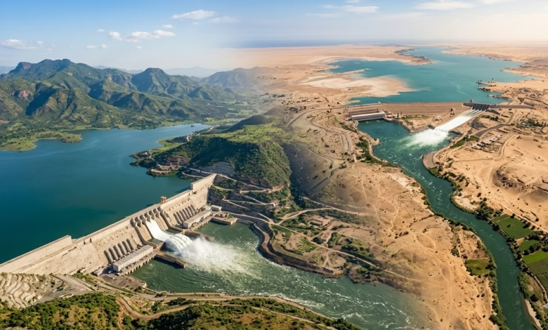
As the longest continental artery on Earth, the Nile River represents the natural cradle and the vital sphere from which the most complex equations of geopolitics and water security in Africa emerge and transform. This great river, which crosses eleven countries during its long journey, does not merely represent a waterway flowing from south to north, but rather it is a living embodiment of interwoven environments, varying terrains, and contrasting economic and social landscapes that color its riparian states. At the heart of this unique hydrological system, the Eastern Nile Basin—specifically the Blue Nile—emerges as the arena for one of the most complex water disputes in modern history, centered around the construction and operation of the Grand Ethiopian Renaissance Dam (GERD).
The rigorous research paper recently published in the prestigious journal “Communications Earth & Environment,” a part of the renowned “Nature” portfolio, titled “Grand Ethiopian Renaissance Dam can generate sustainable hydropower while minimizing downstream water deficit during prolonged droughts,” introduced a highly important scientific and hydrological approach to dismantling this conflict. The study, authored by a high-level research team led by the prominent Egyptian scientist Dr. Essam Heggy (University of Southern California and the Jet Propulsion Laboratory at the California Institute of Technology), does not stop at the boundaries of dry academic monitoring, but rather dives deep into the structure of the stalled negotiations to present an integrated hydro-political and economic reading based on documented hydrological data from a full century of river flows.
To understand the profound dimensions discussed in this study, we must first map the hydro-climatic layout of the river; the Nile passes through five radically distinct climatic zones: from the equatorial and humid region, moving up to the semi-arid, then the hyper-arid, reaching the Mediterranean climate. This variation makes it a highly sensitive hydrological and environmental system, as it represents the sole lifeline and the freshwater sanctuary for downstream countries located in the driest regions of the Sahara Desert, primarily Egypt and parts of Sudan. Throughout modern history, the flow of the Nile has been the hidden maestro driving the rhythm of life in downstream nations; periods of prolonged drought were associated with famines and major crises, while years of average and above-average flow shaped eras of prosperity, social stability, and health for humans across thousands of years.
However, the natural conditions of the river began to witness worrying transformations since the beginning of the twentieth century, many decades before the era of building mega-dams on its main course; documented historical data indicate that the annual average of the Nile’s natural flow has been suffering from a continuous decline since 1900 due to steady shifts in rainfall patterns over the basin. For instance, the river’s average annual flow at Aswan dropped from 109 billion cubic meters in the period between 1871 and 1897 to only about 86 billion cubic meters between 1900 and 2002. This continuous natural decline represents the fragile hydrological ground upon which fears were established, making the construction and development of any massive water project in the upper Nile a source of legitimate existential concern for downstream countries, especially in the absence of a governing institutional coordination.
With the advent of the 1960s, the river states began constructing major dams, a shift that moved the river from its free natural state to a stage of intensive human management that has sparked and continues to spark ongoing disputes, drawing global attention toward the equity of water distribution and its management mechanisms in the basin. Today, two hydraulic giants dominate the scene, completely reshaping the river’s dynamics: the Grand Ethiopian Renaissance Dam, located on the main course of the Blue Nile with a maximum storage capacity of 74 billion cubic meters, and the High Dam in Aswan, Egypt, which represents the largest reservoir in Africa with a capacity of up to about 162 billion cubic meters.
Contemplating these numbers reveals a stunning hydrological reality that the study places before both decision-makers and political analysts alike; the total storage capacity of these two mega-dams combined is equivalent to about 280% of the natural annual average flow of the Nile River at Aswan. This huge figure simply means that the two dams have come to exercise absolute and comprehensive control over the river’s flows, bypassing the natural causes and drivers of hydrology in favor of the operational policies approved by the two countries. Herein lies the core of the conflict: how can two separate administrations be reconciled for two dams that share the exact same water artery, where the hydrological existence of one depends on what the other decides in the upper reaches of the river?
The study then shifts to highlight the fundamental contrast in the philosophy of use and vital function of each dam, a contrast that reflects the nature of the developmental and existential challenges faced by each country across the river. The Grand Ethiopian Renaissance Dam was designed to be the largest hydroelectric power plant in Africa, expected to produce up to 16,000 GWh of electricity annually, compared to about 10,000 GWh generated by the Aswan High Dam. This massive energy ambition is driven by an urgent Ethiopian need; the country suffers from a severe deficit in energy services, with only 45% of the population having access to electricity, placing Ethiopia on the list of the lowest per capita electricity consumption rates in Africa. Hence, the GERD represents a national project to overcome energy poverty, double electricity production, and transform into a regional hub for exporting energy to neighboring countries.
In contrast, the Aswan High Dam takes on a completely different functional dimension; it is not just a power generation plant, but rather the final strategic line of defense and the vital water reserve for the downstream nation in confronting long and prolonged periods of drought. For Egypt, the High Dam represents the safety valve that protects the Nile Valley from violent natural fluctuations, providing a strategic stock that guarantees the survival of the state and the continuation of its agriculture and industry during lean years. Based on this structural difference in interests and fears, the process of building and filling the dam generated sharp political friction; although the first four phases of filling the GERD reservoir (which began in July 2020) benefited from favorable and relatively above-average water flow conditions, supported by the high initial water stock of the Aswan High Dam (which was close to 138 billion cubic meters), the absence of an agreed-upon and documented operational framework opened the door wide to sharp divisions and conflicting visions regarding the long-term impacts of the project on the water and food security of downstream countries.
Negotiations between the three countries (Egypt, Sudan, and Ethiopia) continued for more than a full decade to no avail, driven by the “hydraulic uncertainty” associated with how the GERD would be operated during periods of prolonged drought. Here comes the pivotal role of this study, which re-reads the historical rounds of negotiations, especially those that took place in Washington in 2020 under the auspices of the World Bank and the US administration, attempting to bridge the deep technical gaps by proposing a unified scientific definition of prolonged drought, and formulating flexible operational policies that ensure the flow of energy to Ethiopia and the permanence of water to Egypt and Sudan.
Drought Hydrology and Adaptive Operation Scenarios
The paper moves from the phase of geographical and historical characterization of the Eastern Nile Basin to dive into the complex hydrological structure governing the river’s flows, attempting to put an end to the biggest dilemma that faced negotiators for a whole decade, which is the absence of a unified scientific and operational definition for the phenomenon of “prolonged drought.” The crisis of the Grand Ethiopian Renaissance Dam, in its technical essence, is not a crisis of initial filling, but rather a crisis of water management and governance during periods when rainfall becomes scarce over the Ethiopian Plateau—cycles that the written history of the river has witnessed and that recur due to accelerating climate changes. Here lies the exceptional importance of this study, as it reframes the concept of water security by linking it to the flexible operational capacity of major dams in the basin, instead of clinging to rigid, unilateral visions.
To deconstruct this dilemma, the research team led by Dr. Essam Heggy relied on a massive and highly accurate hydrological database spanning a full hundred years of historical flows observed for the Nile River (from 1900 to 2002). This long time series allowed researchers to simulate the behavior of the river and determine the nature of variations in annual flows, which revealed a recurring and worrying pattern: the river does not follow a single pace, but rather passes through “hydrological cycles” ranging from years of water abundance to years of severe scarcity. Through these data, the study succeeded in formulating a precise mathematical and hydrological definition of prolonged drought, characterizing it as the time period in which the average annual flow of the river at Aswan drops below the threshold of 81 billion cubic meters for several consecutive years, which represents the critical point at which existential risks to downstream countries begin to materialize tangibly.
Based on this scientific definition, the study developed an advanced digital model to simulate three different operational scenarios for the GERD during periods of prolonged drought, attempting to measure the impact of each scenario on hydroelectric power production in Ethiopia on one hand, and on the accumulated water deficit in the downstream countries (Egypt and Sudan) on the other. The first scenario represents “uncooperative” or unilateral operation, a situation in which Ethiopia seeks to maintain the highest possible level of power generation without flexible consideration for downstream requirements. Digital simulation showed that this path leads to catastrophic results for Egyptian and Sudanese water security, causing a massive, accumulated water deficit in downstream countries that may exceed tens of billions of cubic meters during drought years, thereby emptying the reservoir of the High Dam in Aswan and putting it in operational danger.
The second scenario represents “fixed-rule operation,” which is close to the proposals circulated during the Washington negotiations in 2020, requiring Ethiopia to release specific and fixed quantities of water annually during drought periods. Although this scenario provides relative protection for downstream countries, scientific simulation proved its absolute inefficiency; it ignores the annual variations within the drought period itself and leads to a sharp, sudden decline in the GERD’s capacity to generate electricity, which harms Ethiopian developmental interests in a way unacceptable to Addis Ababa, and thus this option remains an unsustainable and politically rejected formula.
Here, the study introduces an innovative third path that represents the true added value of the research, which is the “Adaptive Operational Strategy” scenario. This scenario is based on a dynamic idea that blends real-time hydrological calculations with the concept of regional solidarity; where the water release rates from the GERD and the volume of electricity generation are linked to the state of the actual water stock in the Aswan High Dam and the annual average rainfall. In years of severe drought, Ethiopia agrees to a temporary, voluntary reduction in energy production by a percentage ranging from 10% to 20% only, in exchange for passing additional quantities of water to ensure that the High Dam does not reach critical drought levels. Conversely, in years of abundance, Ethiopia is compensated by increasing storage rates and hydroelectric production.
The simulation results for this adaptive scenario were astonishing and decisive; the study proved with numbers and mathematical models that this flexible method guarantees that Ethiopia maintains sustainable and stable hydroelectric power generation over the long term without sharp interruption, while simultaneously reducing the water deficit in downstream countries to its lowest possible levels, thereby fully protecting the water security of Egypt and Sudan even during the harshest periods of prolonged drought. This scientific result refutes the prevailing narrative that the conflict is a “zero-sum game” in which one party must win at the expense of another’s loss, confirming that a technical solution is possible, available, and mathematically proven.
However, the application of this adaptive model collides with the necessity of activating coordination mechanisms and sharing real-time technical data between the two giant dams (GERD and Aswan), which opens the door to discussing the missing legal and institutional dimensions in the Eastern Nile Basin. The research paper proves that the independent and separate management of each dam on its own, without a direct digital and hydrological link, will inevitably lead to conflicting operational policies, as each dam will try to protect its own stock based on its individual forecasts, thereby deepening the crisis and increasing the likelihood of regional clash upon the occurrence of any unexpected natural drought. In the next installment, we will review how the results of this study can form a cornerstone for reviving a new negotiating path that leads the region out of the current political deadlock.
Institutional Dimensions and Legal Mechanisms for Reviving the Negotiating Path
The paper shifts its analysis from the purely hydrological space and advanced digital simulation models to the political and diplomatic space, placing its finger on the biggest dilemma that has faced the three countries (Egypt, Sudan, and Ethiopia) over the past decade, which is how to translate scientifically proven technical solutions into binding, sustainable legal obligations and institutional frameworks. The study brilliantly deconstructs the reasons behind the failure of previous negotiation rounds, particularly the Washington track in 2020, attributing this deadlock to the disputing parties’ adoption of rigid concepts and zero-sum negotiating positions, where each country sought to secure maximum possible and permanent gains without taking into account the dynamic and changing nature of the Nile River’s ecosystem and hydrology, and the accelerating effects of climate change over the long term.
In this context, the study presents a new philosophical and legal vision that goes beyond the concept of “rigid agreements” that define bilateral water quotas or fixed operational rules that do not change with changing natural conditions, proposing instead an “Adaptive Framework Agreement” model. This proposed legal model relies directly on the results of the flexible operation scenario, which digital simulation proved successful in protecting everyone’s interests. The essence of this legal proposal is based on formulating flexible clauses that allow for periodic review and continuous adjustment of water release and storage rates based on live monitoring and documented hydrological data updated annually, which lifts from the negotiators the burden of predicting an unknown climatic future and reduces the state of “hydraulic uncertainty” that has long fueled mutual political anxieties.
Perhaps the most prominent institutional contribution offered by this study lies in its categorical confirmation of the impossibility of implementing any adaptive operation strategy in the absence of a high-level, joint institutional mechanism for managing dams in the Eastern Nile Basin. The research paper proves with numbers that operating the GERD and the Aswan High Dam in isolation from one another, and based on unilateral estimates by each country, will inevitably lead to deepening crises when any prolonged drought occurs, as each administration will tend to hedge and hold back water to protect its immediate interests. Hence, the true way out requires establishing a “Joint Hydrological Commission” that includes experts and technicians from the three countries, enjoying the authority to oversee the exchange of immediate and transparent data on water levels, river flows, evaporation rates, and energy production, and being responsible for declaring drought states and activating protocols to reduce Ethiopian hydroelectric production and pass water to downstream states according to agreed-upon mathematical metrics.
Moreover, the study opens new horizons for water diplomacy by linking the solution of the GERD crisis to broader regional cooperation files, particularly in the fields of energy and agriculture. The model proposed by the paper, which includes a temporary reduction in electricity generation from the GERD during years of water scarcity to protect the water security of Egypt and Sudan, can be balanced politically and economically through the creation of a “Unified Regional Power Grid.” Under this grid, downstream countries commit to compensating Ethiopia for the temporary deficit in its hydroelectric power during drought periods by exporting electricity generated from their gas, solar, and thermal plants at preferential prices, in exchange for Ethiopia’s commitment to passing vital water. This organic link between the water and energy sectors transforms the river from an arena of geopolitical conflict into an engine for economic integration and shared sustainable development.
This rigorous scientific reading completely reframes the negotiating scene, placing the international community and regional powers before their responsibilities to support a new negotiating track that does not start from the point of historical political disputes, but rather takes off from the technical hydrological realities proven by this study. Scientific data have come to confirm that consensus is not only possible, but is the only viable option to ensure the survival and prosperity of the basin’s peoples. In the next and deeper installment, we will review the long-term environmental and economic dimensions associated with managing the Eastern Nile Basin under scenarios of steady climate change and continuous population growth, and how these factors constitute an inevitable pressure that necessitates accelerating the adoption of adaptive solutions and overcoming the current deadlock.
Climate Change, Population Growth, and Long-Term Environmental Pressure
The study moves its analysis to a further time horizon, bypassing immediate operational calculations to shed light on the pressing hydro-environmental and demographic variables looming on the horizon of the Eastern Nile Basin. The major cognitive value of this research manifests in its refusal to isolate the GERD dilemma from its broader environmental context; the river does not flow in a vacuum, but moves across a regional landscape characterized by population growth that is among the highest globally, and violent climate changes that are redrawing the map of rainfall and evaporation in the African continent. Here, the study places the regional decision-maker before a harsh existential reality: the continuation of traditional and unilateral patterns in water management will accelerate the occurrence of a comprehensive environmental and economic catastrophe, regardless of the size and storage capacity of the constructed dams.
The study dives into deconstructing the riddle of climate change and its dual and contradictory impact on the Nile Basin; mathematical models indicate that the basin is witnessing an increase in the severity of “extreme events,” which means that the region has become vulnerable to years of overwhelming and destructive floods followed directly by prolonged and harsh periods of drought. This sharp fluctuation in the natural flows of the river represents an unprecedented hydrological challenge for dam management; periods of high floods tempt riparian states to increase storage rates and expand agriculturally, creating a false sense of abundance and water security, which is exactly what happened during the early stages of filling the GERD. However, the real danger lies at the tail of these climatic cycles, where historical data confirm that periods of prolonged drought always arrive suddenly, leaving economic and agricultural systems in downstream countries in a state of complete exposure and total dependency on the critical water stock.
In parallel, this climatic shift is linked to a massive demographic pressure, as the Eastern Nile Basin countries are witnessing rapid population spikes that raise the level of demand for freshwater, food, and energy to unprecedented record levels. This population explosion means a steady decline in the annual per capita share of water in downstream countries, especially in Egypt, which is already living under the strict water poverty line. From here, the study shows that any additional water deficit caused by the GERD during drought periods will not be limited to a decline in electricity generation from the High Dam alone, but will reflect directly on the destruction of millions of agricultural acres in the Delta and the Nile Valley, doubling rural unemployment rates, and threatening social peace and national food security for the downstream state entirely.
The research paper puts forward a highly important environmental and economic approach regarding “water-use efficiency” within the basin; data indicate that the current independent management causes massive water waste due to evaporation and seepage from giant storage lakes located in hyper-hot and dry regions. Here, scientific simulation proves that adaptive coordination between the GERD and the High Dam can play a crucial role in reducing this total environmental loss; managing the water stock in a dynamic manner allows for the transfer of water reserves between the two dams based on calculations of annual evaporation rates, saving billions of cubic meters lost in vain into the air, and re-injecting them into the water artery of the river to support sustainable development and agriculture projects in Sudan and Egypt, and secure energy needs for Ethiopia.
These scientifically documented environmental facts bring down narrow political narratives, proving that protecting the Eastern Nile Basin from environmental and water collapse lies beyond the capability of any single country alone. Water security in the era of climate change and population pressure is no longer just a matter of defending historical quotas or sovereign achievements, but has become a precise engineering and hydrological science that requires extreme flexibility and cross-border coordination. In the next and final installment of this reading, we will follow the formulation of the final strategic recommendations and the practical roadmap presented by technical experts to save the future of the basin and put a definitive end to this chronic regional dilemma.
Strategic Roadmap and Building Sustainable Water Peace
In its conclusion, the research paper reaches the formulation of major strategic recommendations that could constitute the true lifeline for the Eastern Nile Basin, transforming the results of hydrological simulation into a practical roadmap applicable to geopolitics and diplomacy. The importance of this final installment lies in providing direct and calculated answers to the most pressing question: how can the three countries (Egypt, Sudan, and Ethiopia) exit the current political deadlock and begin activating the adaptive operation model? The study clearly confirms that the first step toward the solution begins with dismantling psychological and political complexes and recognizing that water solidarity is not a luxury, but rather an absolute necessity to ensure the sustainability of hydroelectric development in the upper river and the permanence of life in the downstream.
The roadmap proposed by the research team led by Dr. Essam Heggy is established upon four interconnected axes that cannot be separated from one another to ensure the success of the system; the first axis manifests in formulating a “Joint Hydrological Emergency Protocol” to be embedded within the legal framework governing the operation of the Ethiopian dam. This protocol defines with mathematical precision that leaves no room for political interpretation when and how to activate plans for a gradual and temporary reduction of energy production at the GERD as soon as the river enters the scientifically defined prolonged drought cycle. Through this prior commitment, the fears of the downstream state regarding sudden unilateral behaviors during times of crisis dissipate, and at the same time, Ethiopia possesses a clear and pre-planned vision of how to manage its national electricity grid without facing uncalculated operational shocks.
The second axis concerns the technological infrastructure necessary to support this dynamic direction, represented by the establishment of the “Unified Regional Data Center for the Eastern Nile.” This center, which the research suggests should be managed by a joint and independent technical staff, will serve as the monitoring eye feeding digital models with real-time data regarding the movement of flows and water stock in both the GERD and Aswan dams, as well as other storage lakes in Sudan. The existence of a unified and reliable technological platform for information exchange completely eliminates the argument of missing hydraulic certainty and prevents the use of water data as a political pressure card, thereby rebuilding lost trust between the technical institutions of the three countries and opening the door to true integrative management of transboundary water resources.
The third axis moves the water solution to the horizons of international finance and investment by putting forward the idea of the “Nile Basin Resilience Fund.” This proposed fund, which could be co-financed by international financial institutions such as the World Bank and the European Union, aims to support projects that raise water-use efficiency in downstream countries, particularly through modernizing irrigation systems in Egypt and Sudan and reducing water loss in distribution networks. In addition, the fund takes over the financing of economic compensations and regional electricity interconnection grids that guarantee the continuous flow of energy to Ethiopia during drought years, making the adaptive operation system a winning developmental deal and an integrated economic bargain for all parties involved, rather than mere technical restrictions imposed on one party over another.
In conclusion, the fourth axis emerges as a political and diplomatic necessity calling for the reactivation of international mediation under a new umbrella combining the African Union, the United Nations, and international partners, provided that this mediation adopts the scientific and hydrological vision presented in this study as a solid ground for negotiations. This historic study proves beyond a doubt that the dispute over the GERD can be resolved engineeringly and scientifically, and that nature has granted the Nile Basin enough resources and flows to ensure the prosperity of everyone if these resources are managed with a collaborative, flexible, and sustainable mindset. Science has provided the solution, and the ball is now in the court of the political will of the basin countries’ leaders to adopt this adaptive path, end the era of zero-sum conflict, and inaugurate a new era of sustainable water peace in the east of the great African continent.