

China And Space
Unraveling The Chinese Spy Network And Information Warfare Doctrine In Washington's Backyard

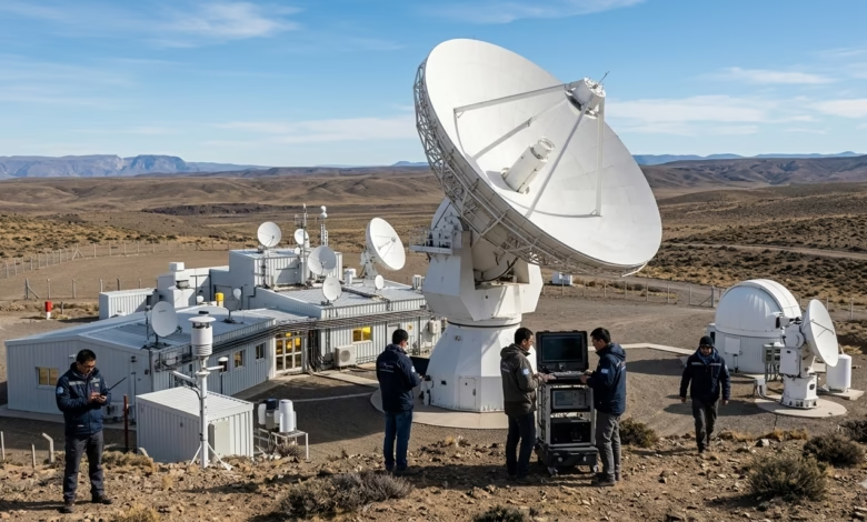
Space As A Backyard: A Strategic Audit In Latin America When Western Capitals, Led By Washington, Look At The Political And Economic Map Of Latin America, The First Things That Come To Mind Are Maritime Trade Lines, Lithium Mines, And Migration Corridors Flowing Northward. However, An Exceptional And Highly Dangerous Report Was Recently Issued By The Select Committee On The Strategic Competition Between The United States And The Chinese Communist Party In The U.S. House Of Representatives, Bearing A Shocking And Direct Title: “China In Our Backyard: Volume II – Pulling Latin America Into China’s Orbit.” This Report Does Not Merely Reinterpret Traditional Chinese Economic Influence; Rather, It Lifts The Veil Of Diplomatic And Scientific Secrecy Over Projects That For Many Years Appeared To Be Innocent Contributions By Beijing To The Development Of The Space Sector And Astronomical Research In The Latin American Continent. It Provides An Investigative Document And A Precise Military Analysis Of How The Chinese People’s Liberation Army (PLA) Is “Weaponizing” The Ground Architecture Of What Is Known As The “Space Silk Road” In Countries Like Venezuela, Brazil, Bolivia, Argentina, And Chile. The Strategic Journalistic Article In Our Hands Today Is Not Just A Display Of Dry Data, But Rather A Deconstruction Of A Highly Complex Engineering Mechanism, Managed By Beijing From The Top Of The Political Pyramid, To Link The Fate Of Latin American National Security To The Technological And Military Wheels Of The Chinese Communist Party. In Its Executive Summary, The Report Confirms One Central Fact: The Chinese Space Facilities Scattered Across South American Terrains — From The Arid Atacama Desert In Chile To The Plains Of Patagonia In Argentina — Are Not Simply Isolated Scientific Projects Or Observatories For Stargazing; Instead, They Form An Integrated, Dual-Use (Civilian-Military) Network Meticulously Designed To Strengthen Beijing’s Capabilities To Monitor, Control, And Potentially Destroy Or Disrupt The Space And Military Operations Of Its Adversaries When Necessary.
First: The Geopolitical Doctrine Of The Space Silk Road
To Understand The Deep Dimensions Of This Report, We Must Return In Geopolitical Memory To November 2009. At That Time, The Commander Of The Chinese People’s Liberation Army Air Force, Xu Qiliang, Made A Historic Statement That Passed Without Sufficient Attention From The Western Media; He Stated That “Military Competition In The Twenty-First Century Will Be Decisively Determined Based On The Domains Of Information And Space, Which Represent The New Strategic High Grounds Overlooking The Arena Of International Competition.” Since That Explicit Announcement, The Technological And Military Machine Of The People’s Republic Of China Has Moved With Steady, Meticulously Planned Steps Toward Space Expansion, Both Within Its Continental Borders And Overseas. Dominance Over Space Infrastructure Is No Longer, In Chinese Military Tradition, A Technological Luxury, But Rather The Foundation Upon Which Modern Military Effectiveness Rests. Global Security And The Contemporary Economy Depend Almost Entirely On Space; Satellites Move Communication Networks, Guide Missiles And Software Via Precision Navigation Systems, Manage Remote Sensing Architectures, And Handle The Massive Data Flows That Drive Both Civilian And Military Economies Alike. For Beijing, These Systems And Satellites, Which Today Exceed 1,000 Active Satellites, Are Not Merely Commercial Tools, But Rather The Beating Heart Of How The Chinese Military Manages Its Operations And Projects Its Influence And Military Power In Regions Far Removed From Its Immediate Geographical Surveillance. Here Lies The Major Engineering And Geographical Obstacle That Beijing Faced: In Order For A State To Guarantee Complete And Continuous Control Over Its Satellites Throughout Their Orbits Around The Earth, It Requires A Ground-Based Network Of Tracking, Telemetry, And Command (TT&C) Stations. Due To The Earth’s Curvature, Stations Located Inside Mainland China Cannot Maintain Direct Connection With Satellites When They Rotate On The Other Half Of The Globe. From This Reality, The Strategy Termed By The Report As The “Belt And Road Spatial Information Corridor,” Or Abbreviated As The “Space Silk Road,” Was Born. Beijing Realized, Through Its Successive National Planning Documents, That Latin America Represents The Ideal Geography And Critical Engineering Location To Close This Connectivity Gap. It Is The Region Geographically Opposite To East Asia, Positioned Perfectly Over The Orbits Of Military And Commercial Satellites Flying Above The Western Hemisphere. Therefore, Chinese Infiltration Into The Latin American Space Sector Was Not Just A Spontaneous Initiative To Offer Technical Assistance In Weather Forecasting Or Natural Disaster Management, As Official Diplomatic Rhetoric Claims; Rather, It Is A Literal Execution Of High-Level Directives From The Political Leadership Of The Chinese Communist Party To Build A Global Military Surveillance System.
Second: Deconstructing China’s Grand Strategy.. Enforced Military-Civil Fusion
The Report Clearly Reveals, Through A Meticulous Review Of Internal Chinese Reports, Government Documents, And Specialized Academic Research, That The “Space Silk Road” Relies On A Strict National Policy Imposed By Beijing Known As “Military-Civil Fusion” (MCF) And National Defense Mobilization Laws. These Laws And Policies Practically And Totally Eliminate Any Real Boundaries Between What Is Commercial Or Scientific, And What Is Military Intelligence. Under The Chinese Legal Framework, Commercial Space And Satellite Companies, Even Those That Appear To Be Startups Or Private Joint-Stock Enterprises, Are Legally Obligated To Include Organs Affiliated With The Chinese Communist Party Within Their Organizational And Administrative Structures. These Party Structures Grant The Chinese State And Military Formal, Direct Paths For Immediate Access To Intellectual Property, Equipment, Hardware, And Even Human Resources. For Example, The Report Clarifies That The Major Chinese Entities Responsible For Building And Managing This Space Infrastructure Abroad — Such As The China Satellite Launch And Tracking Control General (CLTC) — Are Not Independent Civilian Entities; Rather, They Are Structurally And Indubitably Linked To The “Information Support Force” (ISF) Of The Chinese People’s Liberation Army. This Force Is The Arm Of The Military Tasked With Managing Military Information Flows, Protecting Integrated Digital Resources, And Securing Beijing’s Information Superiority In Times Of Both Peace And War. When Beijing Issued The “Space White Paper” In 2016, It Laid Out An Ambitious Plan To Transform Into A “Global Space Power” By 2045. The Latest Edition Of The White Paper In 2021 Reaffirmed The Role Of Space As A “Defender Of National Security.” This Chinese Concept Of Security Connects Directly To A Military Doctrine Termed “Informationized Warfare.” In This Doctrine, Military Victory Is Not Achieved In Traditional Domains (Land, Sea, Air) Except Through Absolute Control Over Digital Systems, Launching High-Precision Guided Strikes, And Disrupting The Enemy’s Command And Control Capabilities By Paralyzing Its Communication Networks. All Of These Complex Military Requirements Fundamentally Rely On A Single Technological Asset That Military Experts Call: “Space Domain Awareness” (SDA).
Third: The Mechanism Of Space Domain Awareness (SDA) And The Concept Of The “Information Umbrella”
What Is Space Domain Awareness, And How Does Beijing Transform It From An Academic Astronomical Term Into A Tool For Warfare Hegemony? The Report Explains This Intelligence Mechanism In Detail. Space Domain Awareness Requires The Capability To Detect, Track, Identify, Characterize, And Understand The Nature Of Every Object Moving In Earth’s Orbits. This Includes Active Satellites Belonging To Other Countries (Which May Be Western Spy Or Military Satellites), In Addition To Space Debris. Beijing Does Not Run These Facilities In Latin America To Monitor Distant Stars Or Galaxies, But To Establish What Chinese Strategic Documents Call An “Information Umbrella.” This Umbrella Functions As Follows: A Chinese Satellite Dedicated To Space Surveillance In Low Earth Orbit (LEO) Monitors And Images A Hostile Satellite Or Foreign Military Target. This Sensitive Data Is Immediately Transmitted To A Chinese Communications Satellite, Which In Turn Sends It As Downlink Wireless Signals To One Of The Ground Stations Scattered Across Latin America. From There, Data Flows Via Fast, Secure Local Ground Networks To Massive Cloud Processing Data Centers, Where It Is Decrypted, Analyzed, And Forwarded Directly To The End User: “People’s Liberation Army Base 37” (PLA Base 37). “Base 37” Is Considered The Highest Executive And Command Arm In China For Managing The Space Domain Awareness File; It Is Responsible For Determining The Intelligence Identity Of Foreign Space Objects And Measuring Their Orbital Trajectories. By Integrating Data Coming From Latin American Stations, This Base Provides The Entire Chinese Military With A Live, Interactive, And Continuous Picture Of Everything Happening Above Our Heads In Space. This Direct Picture Is What Drives And Guides The Decisions Of Chinese Forces On The Earth’s Surface And In Orbit; This Grants It The Capability To Plan Anti-Space Operations, Such As Utilizing Anti-Satellite (ASAT) Weapons, Activating Electromagnetic Jamming Systems, Or Guiding Intercontinental Ballistic Missiles And Hypersonic Weapons By Providing Final Guidance Along Their Re-Entry Paths Toward Their Targets. The Fundamental Difference Between The Chinese Model And The Western Model In Managing Ground Space Stations — As Highlighted By The Report With Analytical Acumen — Lies In The Political Architecture Of International Relations. The United States Relies, In Deploying Its Ground Stations, On A Broad Network Of Formal Allies, Partners, And Long-Term Mutual Security Agreements With Countries With Which It Shares Transparent Strategic Relations. On The Other Hand, China, Which Possesses A Very Short And Limited History In Building Equal International Military Alliances, Lacks Direct, Easy Access To Ground Stations Abroad. Therefore, It Historically Resorted To Relying On Massive Numbers Of Compensatory Satellites In Low Orbit To Overcome This Geographical Deficit. Today, However, And As Proven By The U.S. Congressional Investigation, It Is Upending These Rules Through Aggressive, Covert Expansion In Upgrading And Establishing Ground Stations In America’s Backyard, Exploiting Legal And Diplomatic Loopholes And The Needs Of Latin American Governments Eager For Investment And Technology.
Fourth: The Argentine Theater.. Pierced Sovereignty In The Plains Of Patagonia
When We Move From Geopolitical Theorizing To The Reality Of The Physical Ground, The Report Issued By The Select Committee Of The U.S. House Of Representatives Highlights A Network Of Eleven Chinese Space Facilities Extending Like Cobwebs Over The Map Of South America. These Facilities Do Not Fly Military Flags; Instead, They Cloak Themselves In The Garb Of Joint Academic Scientific Cooperation And Astronomical Research For Outer Space Management. However, Close Technical And Investigative Examination Of The Contents Of These Bases Proves That They Possess “Dual-Use” Capabilities Structurally And Operationally Linked To Entities Affiliated Directly With The PLA. At The Forefront Of This Field Theater Comes The Republic Of Argentina, Which In Recent Years Has Transformed Into The Hard Core Of Chinese Space Presence In The Western Hemisphere.
The Deep Space Station In “Espacio Lejano”.. The Black Box In Neuquén The Espacio Lejano Station, Located In The “Bajada Del Agrio” Region Of Argentina’s Neuquén Province, Is Considered The Most Blatant And Dangerous Model Of What The Report Describes As “Silent Sovereign Infiltration.” This Station Was Established And Began Official Operations In 2018 Under A Cooperation Agreement Between The China National Space Administration And The National Space Activities Commission Of Argentina. Publicly, The Station Was Promoted As A Vital Scientific Center To Support Chinese Deep Space Missions, Specifically The “Chang’e” Probe Family Specialized In Moon Exploration and Future Research Aimed At Mars. However, Hidden Details Within Leaked Chinese Technical Reports, Which Were Deconstructed By The Congressional Report, Reveal A Completely Different Technical Reality. Beijing Tested Advanced Technology At This Station Known As “Very Long Baseline Interferometry” (VLBI), A High-End Engineering Technique Used To Measure Vast Distances And Orbital Objects With Extreme Precision. The Technical Surprise Uncovered By The Investigation Is That The Current Data Transmission Capabilities Of The Station Are Insufficient For Sending Complete Astronomical VLBI Data In Real-Time To The Capital, Beijing. This Means Analytically That While The Station Fails To Fully Fulfill The Civilian Scientific Purpose Written In Its Founding Contract, It Operates With Absolute Efficiency In Service Of The Military And Security Applications Of The People’s Liberation Army. The Station Possesses A Giant High-Gain Antenna Measuring 35 Meters In Diameter, Capable Of Operating In The S-band, X-band, And Ka-band Frequency Standard Collections. These Frequencies Are The Very Ones Required To Run The VLBI System. However, In Military Intelligence Tradition, These Massive, High-Gain Dishes Are Used As Highly Powerful Tools For Gathering Electronic Intelligence (ELINT) And Signals Intelligence (SIGINT). These Dishes Can Capture And Intercept Faint Wireless Signals Emitted By Foreign Satellites Or Deep Space Probes, Passively And Covertly Monitoring Downlink Frequencies Of Other Countries To Analyze Their Movement Patterns and Communications. What Causes Alarm In U.S. Defense Circles Is The Unique Geographical Location Of This Station In Patagonia. It Lies Roughly On The Same Geographical Longitude That Passes Through The Eastern Coast Of The United States, And Is Separated From The Equator By Approximately The Same Distance That Separates Washington D.C. From It. This Geometric Positioning Grants The Chinese Antenna An Ideal, Direct Line Of Sight To Most Satellites Stationary In Geostationary Earth Orbit (GEO) That Serve Military Operations and Vital Communications In The Eastern United States. This Station Is Managed and Operated Entirely By The “Xi’an Satellite Control Center,” An Entity Subject Directly To The Military’s China Satellite Launch And Tracking Control General (CLTC). What Is Striking Here Is The Unfair Legal And Diplomatic Nature Of The Agreement Signed By Argentina In 2015. Buenos Aires Granted China A Long-Term, 50-Year Contract Covering An Area Of 200 Hectares, With The Exclusive And Complete Right Of Construction And Operation Without Paying Any Taxes To The Host State, Backed By Direct Chinese Financing Exceeding $54 Million. Despite Signing An Addendum In 2016 Stating That The Station Must Be Used For Civilian Purposes Only, The Report Flashes A Legal Surprise: Argentina Installed No Independent Mechanisms For Oversight Or Inspection. Argentine Citizens and Officials Are Entirely Excluded From Performing Inspections Inside The Site, Rendering The Station A Sovereign “Black Box” And An Integral Part Of The Deep Chinese Space Network Used To Relay Military Reconnaissance Satellite Data And Support Anti-Satellite Weapon Experiments.
Fifth: The Expansion Of Laser And Encrypted Communications In Argentine Depths
Beijing Did Not Stop At The Neuquén Station, But Continued To Weave Its Threads Across Other Argentine Terrains To Diversify Its Technological Mediums In Space Surveillance And Signal Interception.
The Félix Aguilar Astronomical Observatory In San Juan In San Juan Province, The National Astronomical Observatories Of China (NAOC) Established An Advanced Satellite Laser Ranging (SLR) Project That Began Operating In 2005 In Partnership With The Local Observatory. This System Was Designed and Developed By The Chinese Academy Of Surveying And Mapping In Cooperation With The Chinese Academy Of Sciences, Financed Directly By The Ministry Of Science And Technology In Beijing. This Project Is Viewed Today As The Most Active Location In Latin America For Laser Ranging Technology. The Site Features A Laser Telescope With A Diameter Of 60 Centimeters, Equipped With Adaptive Optics Systems To Correct Atmospheric Distortions. In Appearance, The Station Collects Geodetic Data To Study the Earth’s Shape. In Military Substance, However, The Millimetric Tracking Accuracy Permitted By This Telescope Affords The Chinese Military Highly Precise Orbital Data That Can Be Redirected and Used Directly In Anti-Satellite Defense Operations, Or To Aim Laser Beams Capable Of Blinding and Destroying Optical Sensors Of Western Spy Satellites (Dazzlers). It Also Contributes To Enhancing The Accuracy And Reliability Of Long-Range Ballistic Missile Systems Via Absolute Auditing Of Coordinates And Launchpad Locations. Beijing Had Planned To Expand This Site Via A Giant Radio Telescope Project Named CART, With A Diameter Of 40 Meters. However, Mounting Security Concerns Over The Possibility Of Using This Astronomical Monster To Advance Chinese Intelligence Capabilities And Locate Deep Military Geographical Coordinates Prompted The Argentine Government In 2025 — Under Tremendous Economic And Political Pressures Formed By The Trump Administration To Weaken Beijing’s Influence — To Completely Freeze And Halt The Radio Telescope Project.
Rio Gallegos Ground Station.. Hidden Connections With Launch Bases In The Far South Of Argentina, Specifically In “Rio Gallegos,” Another Chinese Focus Point Appears, Passed Under A Purely Commercial Cover. The Establishment Of The Rio Gallegos Ground Station Was Facilitated Through A Commercial Partnership Between An Argentine Technology Company Named Ascentio Technologies and A Private Chinese Firm Named Emposat (Beijing Aerospace Yuxing Technology). Despite The Station Gaining An Official License As A Civilian Facility From The National Communications Ente Of Argentina In 2021, The Investigative Report Uncovers Scary, Deep Security Ties Linking The Personnel Of The Chinese Company Emposat To The Military Infrastructure Of The PLA. The Professional Backgrounds Of The Company’s Cadres Were Tracked, Revealing Their Direct Association And Previous Work Within Military Bases 25 And 26 Appertaining To The PLA. These Two Bases Are Essentially Command, Control Centers, and Higher Strategic Hubs Tasked With Managing and Conducting Chinese Military Satellite And Space Launch Operations. The Station Was Equipped With Four To Six Antennas Working In The X-band And C-band Ranges, Which Are Frequencies Capable Of Securing Heavily Armored Encrypted Communications Required For Modern Electronic Warfare Operations And Military Data Routing.
Sixth: The Venezuelan Quad.. Positioning Inside Military Airbases
If Argentina Has Granted China A Foothold Under Complex Scientific And Commercial Investment Banners, Venezuela, Beijing’s Longstanding Ideological And Political Ally, Has Opened The Doors Of Its Military Facilities Directly To The Infrastructure Of The Space Silk Road.
The “El Sombrero” Ground Station.. In The Heart Of The Fighter Jet Lair The El Sombrero Satellite Ground Station, Officially Recognized In Venezuelan Documents As The “Baemari” Station, Is Situated In A Distinctly Military Location. It Is Nested Within The Perimeters Of The Captain Manuel Ríos Air Base In Guárico State. This Airbase Is Far From A Civilian Facility; It Is The Logistic Hub And Core Military Anchor Hosting And Operating The Fleet Of Venezuelan Russian-Made Jet Fighter Aircraft Of Type Sukhoi Su-30MK2. The Station, Whose Construction Was Undertaken Entirely By The State-Owned China Great Wall Industry Corporation (CGWIC), Was Outfitted With Computing Systems and Massive Tracking and Control Antennas. In 2023, This Relationship Assumed A New, Strategic, And Highly Dangerous Dimension When Caracas Signed An Agreement To Join The International Lunar Research Station Project Led By Beijing. By Virtue Of This Accession, Venezuela Granted The PLA and Chinese Entities Direct, Unfettered Access To The Ground Control Infrastructure At The El Sombrero Station. This Access Permits China To Use A Facility Sitting In A Combat Airbase As An Advanced Jumping Point For Its Intelligence Space Domain Awareness Network.
Luepa Ground Station.. The Covert Backup Support System For Added Fortification and To Ensure The Continuity of Intelligence and Space Data Flows, China Constructed The Luepa Ground Station For Satellite Control In Bolívar State, Venezuela. This Station Functions Officially As A Backup System For The Main El Sombrero Station To Prevent Any Disconnection From Space Assets In Case The First Facility Encounters Any Emergency Or Attack. This Sensitive Site Is Managed Directly By Cadres and Engineers From The China Great Wall Industry Corporation (CGWIC), Where It Is Employed To Execute Tracking, Telemetry, And Command (TT&C) Operations, Monitor Satellites, and Calculate Their Orbital Coordinates Free From Any Authentic Local Oversight.
Seventh: The Bolivian Knot.. The Debt Trap and Extended Technological Dependency
If Argentina And Venezuela Offered Geography And Military Quarters, Bolivia Stands As A Stark Example Of How Beijing Deploys Massive Financial Loan Instruments As A Long-Term Geopolitical Trap To Extract Technological And Space Sovereignty, An Act Termed By The House Select Committee Report As The Structural Institution Of Orbital Dependence.
The “La Guardia” Ground Station In Santa Cruz.. Monopolization Of Cadres And Shared Frequencies The La Guardia Ground Station, Located In Santa Cruz, Bolivia, Is A Highly Sensitive Dual-Use Node Within The Chinese Space Information Corridor. This Station Was Constructed Fully By The China Great Wall Industry Corporation (CGWIC) Under Direct, Sustained Technical Supervision From The PLA-Affiliated China Satellite Launch And Tracking Control General (CLTC). Publicly, This Station Acts As A Backup Support Site To Operate The Bolivian Satellite Túpac Katari (TKSAT-1). However, The Genuine Deception Lies In The Financial Architecture Of The Project; The Facility Was Funded Via A Heavy Financial Loan Granted By The People’s Republic Of China Valued At $250 Million. This Intricate Financial Setup, Heavily Burdened With Commitments, Was Not Merely A Commercial Deal, But Was Engineered to Secure A Permanent, Protracted Chinese Technical and Military Presence Inside Bolivia Spanning At Least Until 2028. Under These Arrangements, Chinese Experts and Engineers Remain Embedded At The Absolute Center Of Day-To-Day Station Operations. The Station Is Furnished With Giant Parabolic Antennas With Diameters Of 13 Meters and 5 Meters, Possessing Tracking, Telemetry, and Control (TT&C) Capabilities That Are Dual-Use By Technical Nature. These Antennas Are Able To Operate In The Ku-band And C-band Ranges. While These Frequencies Ostensibly Serve Civilian Broadcasting and Environmental Sensing Spheres, They Gift The PLA A Stupendous Military Advantage; The Location Hosts A “Space Image Processing and Analysis Laboratory” Allowing High-Precision, Complex Remote Sensing Studies, Which Can Be Redirected and Deployed Instantly To Aid Military Intelligence and War Topography Mapping Targeting Beijing’s Foes. Moreover, Technically Integrating This Station With Entities Associated With The Chinese Military Permits It To Contribute Actively To The Space Domain Awareness (SDA) Framework, Monitoring and Computing The Orbital Paths Of Satellites Belonging To The United States And Its Western Allies. The Facility Spans An Area Of 900 Square Meters, Interlocking A Technical Administrative Block, A Power Station, And A Whole Antenna Field To Solidify Real-Time Cloud Data Processing.
Amachuma Ground Station In La Paz.. The Leased Global Kill Chain On The Alternate Flank Of Bolivian Geography, The Amachuma Ground Station Stands Out In The “Achocalla” District Of The Capital, La Paz, Originating As The Principal and Primary Ground Control Station For The TKSAT-1 Satellite. The Construction Of This Strategic Meticulous Facility Was Finished In 2013 By China Great Wall (CGWIC), Distinguishing Itself By Possessing Six Giant Parabolic Antennas, Including Three Enormous Dishes Measuring 13 Meters In Diameter, Each Weighing Nearly 40 Tons, Designed and Installed By Embedded Chinese Technical Staff. The Substantial Transmission and Reception Potential Enjoyed By The Amachuma Station, Coupled With A State-Of-The-Art Image Processing Lab, Alters It Into A Direct Operational Extension of What Is Known In PLA Military Doctrine As The “Global Kill Chain.” This Technical Setup Permits Beijing To Locate Moving Military Targets Across The American Continent and Track Them With High-Resolution Space Radars, All In The Absence Of Any Regional Monitoring By Host Governments. A Far More Severe and Shocking Matter Uncloaked By The Report Is What Was Expressly Mutured By Iván Zambrana, Head Of The Bolivian Space Agency, Who Openly and Explicitly Confessed That The Facility Regularly “Leases Excess Antenna Time” To Chinese Governmental and Military Outfits To Be Disposed In Directing Private Chinese Satellite Launches. This Acknowledgment Meaningfully Projects That Beside Bolivian Staff Trained In China, Satellite Operations Personnel and Technical Officers Linked To Beijing Sustain A Continuous Operational Presence Inside Bolivian Bases, Exploiting Premium Hardware To Execute Intelligence and Combat Tasks Conserving Purely Chinese Military Aims.
Eighth: The Chilean Theater.. The Battle Of Supercomputing In The Atacama Desert
When We Arrive At Chile, We Find Ourselves Confronting A Different Genre Of Exploitation; Chile Is Not An Ideological Ally Of Beijing Like Venezuela, But Rather A State Historically Sharing Intimate Ties With The Western And American Matrix. Nevertheless, China Reached Success In Penetrating Its Unique Astronomical Geography via Digital Technology and Supercomputing Arrays.
The Sino-Chilean Data Center In Santiago And Huawei’s Supercomputer The Chilean Atacama Desert Is Deemed The Holiest Astronomical Location On Earth Given Its Absolute Atmospheric Clarity and Total Aridity; This Blessed Reality Transformed It Into A Hub Nesting The Greatest Global Observatories Affiliated With America and Europe. From This Stance, Beijing Strived To Implement The Sino-Chilean Astronomical Data Center In Santiago, Driving A Triple, Highly Canny and Dangerous Venture Gathering The Chinese Academy Of Sciences, The Chinese Tech Giant Listed On American Sanction Indexes Huawei, and The Federico Santa María Technical University In Chile. The Declared, Propagandistically Uplifted Target Of The Center Was To Leverage High-Performance Computing and Artificial Intelligence Platforms Owned By Huawei to Process Massive Astronomical Datasets Produced By The Renowned Atacama Large Millimeter/submillimeter Array (ALMA) Observatory. Yet, The Congressional Report Warns Of A Deep Software Hoax: The Very Algorithms and Program Blueprints Modeled and Deployed To Filter Noise and Atmospheric Artifacts From Signals Inbound From Deep Space Contexts And Map Faint Galaxies, Are The Veritable, Unchanged Systems, Ready For Instant Migration, Set For Exploitation In Collecting Military Signals Intelligence (SIGINT). This High-Performance Computer Cluster Can Catch, Catalog, and Decrypt Extensively Sensitive Data Caught From Tactical Wireless Streams Traversing The Region Sent Towards Western High-Tier Facilities. Chinese Ambition Dilated Outward From Santiago, Multiplying Across The Atacama Soil via An Object Tracking Project Within The “Ventarones Astronomical Park.” Under The Banner Of Civilian Surveys Searching Near-Earth Asteroids to Protect The Globe, Tracking Technologies Coinciding Architecturally With Arrays Targeted For Intercepting And Killing Satellites Were Instigated. Defensive Misgivings Multiplied Exponentially Upon Examining Staff Records; It Surfaced That The Eminent Chinese Scientist Managing The Enterprise, Jing Liu, Carries Established Connections With PLA Military Unit 93147. This Specific Unit Is A Heavily Classified Branch Expressly Formed For Satellite Engineering, Military Radar Imagery, and Orbital Reconnaissance. By Infiltrating These Military Specialists Inside A Civilian Scientific Park Dropping Just A Few Kilometers Away From High-Value American and European Space Elements In Chile, Beijing Locked In A Permanent Spy Baseline. The Broadcast Of These Specific Details Created A Diplomatic And Security Earthquake In 2024; The American Ambassador In Santiago Championed A Blatant Series of Demands and Warnings Pointed Straight To The Chilean Cabinet Regarding Cyber espionage Risks Encompassed In This Center and The Consequences of Having Huawei and The PLA In The Astronomical Backyard. Spurred By These Verifiable Deficits, The Chilean Administration Enacted A Decisive Move In 2025, Publishing A Total Cancellation Freezing The Entire Chinese Space Outlay To Defend Its National Security and Communications Sovereignty.
Ninth: The “Santiago” Satellite Station.. Lessons From Replicated Swedish Penetration In Alternate Chilean Terrain,
The Santiago Satellite Station Rests In The Andes. This Outpost Formed Its Track As A Collaborative, Purely Scientific Meticulous Workspace Formed For Space Research and Telecommunication Technology Intermeshing The Swedish Space Corporation and China’s CLTC. However, In 2020, The Swedish Corporation Took A Dramatic and Sharp Judgment To Permit Contracts Coinciding With The Chinese Contingent to Expire and Refuse Any Extensions. This Staunch Swedish Resolution Crystalized After The Swedish Defence Research Agency (FOI) Documented That China Was Utilizing Access Portals Accorded Over Antennas and Ground Tracking Stations In Sweden to Perform Transnational Military Intelligence Assembly and Space Surveillance, Trampling The Boundaries Of Peaceful Trade Use. The Extant Physical Base At The Santiago Chilean Station Comprises A Sophisticated Line-Array Fabricated From Four Baselines Specialized In Sweeping Targets Traversing Space At Extreme Speeds, Integrated With A High-Barrier Fenced Yagi Antenna Compound. While These Instruments Are Appointed For Peaceful Scientific Satellites, The Congressional Evaluation Validates Their Comprehensive Power to Gather Signals Intelligence and Trap Encrypted Military Messaging. This Systematic Trajectory Census Allocates The PLA With Topographical Maps Cataloging Coordinates of Foreign Operational Elements; This Sets Open Trajectories For Assaults Or Neutralization Tasks via Cyber Or Physical Force Vectors In Forthcoming Combative Outbreaks.
Ninth: The Brazilian Infiltration.. Historical Cooperation And Forging Shared Orbital Awareness
Brazil Stands Distinct From Co-Regional Latin American States Owing To Its Possession of The Oldest and Deepest Technological Space Pact Linked To Beijing, A Alliance Forged Three Decades Ago and Manifested In The China-Brazil Earth Resources Satellite (CBERS) Framework. Nevertheless, The Present Technical Transition Displaced This Alliance From Surveying Forestry and Weather Networks, Merging It Instead With The Functional Machinery of The PLA’s Military Space Domain Awareness.
Tracking And Control Stations In “Espas” And “Alcântara”.. Sealing Geographical Windows Brazil Anchors Its Orbital Management via The National Institute For Space Research (INPE), Supervising Critical Junctions In Association With China. Prominent On This Operational Map Are The Tracking, Telemetry, And Command (TT&C) Nodes Rested In Cuiabá and Alcântara. These Intercept Bases Were Over Years Stacked With Advanced Chinese Machinery and Refined Feeds On The Plea of Processing CBERS Packets and Discharging Functional Orbits. Yet, The Investigative Findings From The U.S. House Document Expose A Severe Cyber Operational Breach. These Brazilian Sites Are Electronically Wired via Shielded, Encrypted Paths Straight To The PLA-Run China Satellite Launch And Tracking Control General (CLTC). This Deep Connectivity Grants Beijing, Midst Kinetic Contests Or Armed Outbreaks, The Ability to Divert Brazilian Antennas As Alternate Relay Stations Operating For Chinese Reconnaissance Satellites Enclosed In The Yaogan Spy Array. The Alcântara Ground Station Explicitly Secures A Geostrategive Matrix Beyond Wealth; It Standardizes Just Steps Away From The Equator. This Absolute Physical Coordinates Present The Chinese Grid With A Supreme Electro-Optical Window To Track Flight Vectors and Spaces Crossing Equatorial Trajectories, Specifically American Space Fortresses Monitoring The Atlantic and South American Continents. Thereupon, Ground Structures Built By Brazil Shift, Cognizantly Or Blindly By Regional Authorities, Into Auxiliary Espionage Relays Fostering The Goals Of China’s Information Support Force (ISF) To Perfect Target Records and Appraise Intercept Maps Mapping Western Forces Instantly.
Tenth: Military And Security Implications.. Paralyzing The American “Kill Chain” This Densely Woven, Coordinated Chinese Expansion In Latin America Does Not Focus Solely On Supplanting Washington Diplomatically; Its Prime Agenda Focuses On Building An Unbroken Martial Apparatus Primed To Evaporate American Tactical Primacy In Any Coming Global Engagement, Especially A Flashpoint Centered On The Taiwan Strait. The House Select Committee Sums Up The Combined Defense Blows From This Space Grid Into Three High-Threat Vulnerabilities:
-
1. Blinding Washington And Paralyzing Satellites: If Kinetic Strikes Commence, The CCP Can Harness Refined Spatial Mapping Gained From VLBI and SLR Laser Feeds Extracted From Argentina and Bolivia to Guide Precise Anti-Space Assaults. This Entails The Command Of Direct-Ascent Kill Assets (Suicide Cubes Or ASAT Rockets), Or Triggering Dense Electronic Jamming Broadside From Land Dishes To Fracture American Intelligence Links (Like The Milstar Matrix). This Fracture Suffices To Blind American Command Groups, Barring Identification Of Inbound Chinese Naval And Aerial Units.
-
2. Routing Hypersonic and Ballistic Missile Forays: Ground Sites Settled In Latin America Directly Facing East Asia Maintain Seamless Streams Composed Of Unbroken Control Pulses Steering Hypersonic Glide Vehicles and ICBM Vectors Traversing The Western Sky. Bases Like Neuquén and El Sombrero Direct Micro-Adjustments to Missiles, Routing Demolition Projects Snapping High-Value Centers On Continental U.S. Territory, Dismantling The Defensive Matrix Formed In Patriot And THAAD Installations.
-
3. Electronics Espionage And Intercepting Channels (SIGINT): The Fact That Chinese Terminals In Latin America Exist Isolated From Host-State Inspection Teams Mutates These Compounds Into Premium Surveillance Sanctuaries. Enormous Dishes Can Ensnare Atmospheric Audio Streams And Sensitive Packets Filtering Over The Continent, Breaking Ciphers Ruling Western Naval Or Cargo Networks, Monitoring Fleet Formations Supervised By U.S. Southern Command (SOUTHCOM).
Conclusion And Outlook: Confronting The “Orbital Snare” And Reclaiming Equilibrium Volume II Of “China In Our Backyard” Discloses That Beijing Transformed Space Structures In Latin America Into An Orbital Snare, Locking Down An Advanced Combat Infiltration Strip, Exploiting Regional Thirst For Financial Aid and Capital, Flowing In Midst Long Intervals Of American Apathy Or Strategic Inaction Towards The Region. Facilities Like Espacio Lejano In Argentina Or El Sombrero In Venezuela Repudiated Peaceful Trajectories; They Merge As Joint Warfare Systems Coordinated Under The Broad Doctrine of Informationized Warfare Steered By The PLA. While Particular Partners Like Chile Or Argentina Opened Retaliatory Frameworks In 2025 — Responding To Resolute American Defensive Demands — Freezing Particular Ventures, The Core Grid endures, Active, Intact, And Armed. Countering This Muffled Growth Mandates That Washington and Transatlantic Allies Step Past Basic Verbal Condemnations, Providing Viable, High-Transparency Technological and Capital Options To Latin Partners, Boosting NASA In Tandem With Private Space Consortiums. The Battle Commanded Over Space Boundaries Does Not Play Solely On Stratospheric Orbits; Verdicts Rest On Which Hegemon Rules The Ground Feeds and Data Nodes Sown In America’s Backyard. Should Washington Delay In Reclaiming Geopolitical Initiative, Beijing Will Retain Full Authority To Wire The Strings of Its Global Kill Chain From The Fields of Latin America, Restructuring The Continent Into A Dedicated Orbit Serving The Chinese Communist Party.